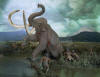
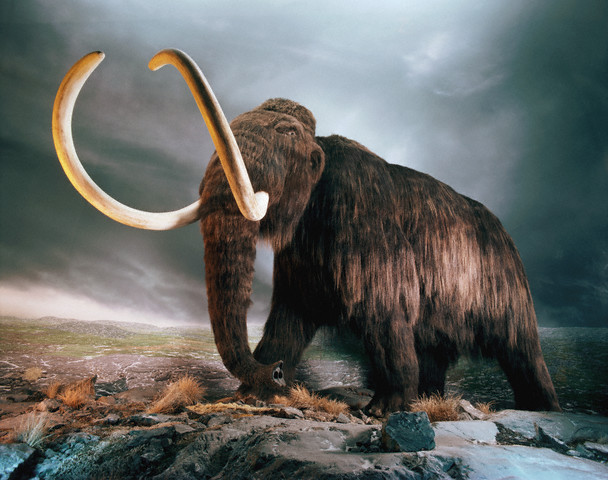
12,000 YEARS AGO

◄Mammoth
and Mastodon live in the area.
Retreating glacial ice
heads northward, finds new strength and re-advances to the south,
then stalls. Melting ice at this static point slopes to the north at
an angle of 20 to 30 degrees. The melt-water along this front,
deposits mounds of debris forming the
Pinnacle
Range, a range of hills
extending four miles, forming Cobb's Hill, Pinnacle Hill (the
tallest at 230 feet), the hills of
Highland Park,
Mt.
Hope
Cemetery and the
University of
Rochester River Campus.
Evidence
of how important the glacial action has been to this area as we know
it, is all around us. It is easily seen in the fertile soil, the
Great Lakes, and the
Finger Lakes.
Retreating ice exposes a new outlet, and
Lake
Dawson's level rapidly drops 45 feet, creating
Lake
Iroquois (elev. 435 feet). This in
turn drains
Lake
Scottsville, and moves the mouth of the Genesee
a mile further north, to a point just north of the Veteran's
Memorial
Bridge. Rapids at the Niagara
Escarpment have eroded to form a 40 foot falls, just north of
today's
High
Falls. Two new sets of rapids are
formed between the escarpment and the river mouth.
Lake
Iroquois
remained long enough, so that it's shoreline can still be seen.
Extending 150 miles from Sodus to
Lewiston it forms a
ridge that the Indians would follow as a primary east-west trail.
Stagecoach lines follow it from 1818 to 1848. Today's NY Route 104,
or
Ridge Road follows
this same geologic formation.
Land
slowly rebounds from glacial weight. (Imagine squeezing a rubber
ball, when you release the pressure it returns to it's original
shape.)Because more weight was removed from the Canadian side of the
lake, it is raising faster. Even though the land has risen 250 feet
in
Rochester, northern portions of the
lake have rebounded nearly 500 feet. The faster rebound on the
Canadian side is causing
Lake
Ontario is literally spill onto
New York, forming the
many ponds and the wetlands along the lake shore. The original
outlet of the river has also flooded, forming
Irondequoit
Bay.
10,000 Years Ago
Climate
starts to warm, plants and animals start to reappear.
8000 -500
BCE
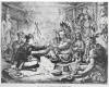
Earliest
people in region are the Archaic Algonkins. They came in small
wandering groups, hunting and fishing. Evidence of these people is
scattered across the area, with two sites located on
Irondequoit
Bay, and the River Campus
of the
University of
Rochester.
After several thousand years they developed a rather advanced
culture in the villages they built.
Eskimos
also wandered in this area. At some unknown period they were hunting
and fishing in the hills to the south, where they left
characteristic knives of rubbed slate.
There is
evidence of a community at the northern end of
Maplewood
Park near a
flint deposit.
Early
settlers at Kings Landing said that they had found remains of a
pallisaded village. Signs of
Indian campsites were located at the Charlotte Lighthouse, and
several other locations along the lake and river.
Rattlesnakes and Malaria were the most likely impediment to
permanent settlement of the area.
1300
Indians
from the
Ohio River valley migrate to the
area.
Seneca Indians inhabit the region. They were
most powerful and warlike tribe of the Iroquois Nation. They lived
between the
Genesee
River and
Seneca Lake.
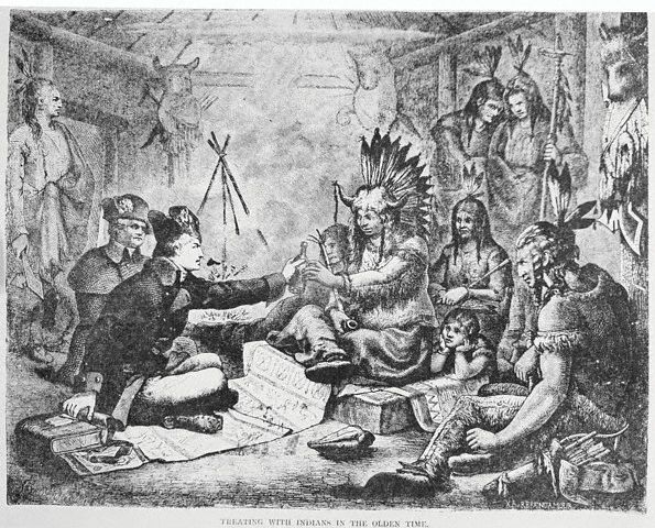
 ◄Man's first contact with the area came with the Indians,
but they were displaced by the advancing tide of settlers from the
east, drawn by the fertile land in the
Genesee
Valley
◄Man's first contact with the area came with the Indians,
but they were displaced by the advancing tide of settlers from the
east, drawn by the fertile land in the
Genesee
Valley
1300’s.
An early Indian trail traced the original route of
East Avenue. About midway between Clover
and Winton Streets the main portage on the secret Indian route
connecting the Great Lakes to the Mississippi
River forks. The right-hand trail follows the route of
today's East Avenue heading
for the High
Falls
of the Genesee. Just before
reaching the falls the trail crossed another path at today's
intersection of Franklin and St. Paul St. This North-South route
connected the southern end of the Mississippi
portage with the mouth of the Genesee.
Seneca Indian
trails cross the area. They were eventually built into today's main
roads:
The trail
from the west became
Brooks Ave.
From the
south, we now have
Scottsville Rd.
The northern approach to the city has become
Plymouth Ave. and
Genesee St.
1629.
King
Charles I of
England grants
all land between the 34th and 45th parallel, from coast to coast, to
the Massachusetts Bay Co
1664. King Charles II of England gives his brother,
the Duke of York, the same land grant that his father had given the
Massachusetts Bay Co. thirty five years earlier.
1752.
Col. Rochester born February 21
1761.
'Views of
Upper and
Lower
Genesee
Falls' published in
London.
1779. Gen. Sullivan's campaign of scorched earth
rids area of Indians.
1811.
East Ave.
cut through the woods, four miles from Orringh Stone's Tavern to the
river
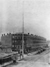
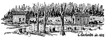
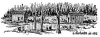 ◄1812
– New houses among the trees in
Rochester, New York.
◄1812
– New houses among the trees in
Rochester, New York.
1812.
Rochester
post office established, A. Reynolds postmaster
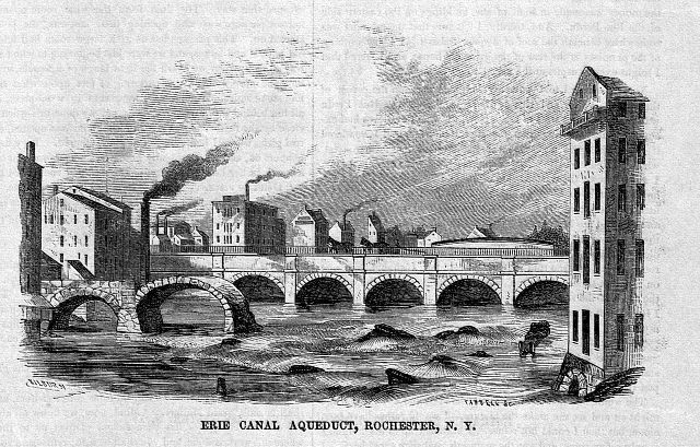
 ◄1820’s.
In the early 1820's the Erie Canal
passed through the area, and the settlers now arrived in a flood
tide, bringing civilization to the wilderness.
◄1820’s.
In the early 1820's the Erie Canal
passed through the area, and the settlers now arrived in a flood
tide, bringing civilization to the wilderness.
1822.
First
sidewalks.
1830.
Original Liberty Pole erected at
triangular intersection of
East Avenue, Main
and Franklin Streets. This date may be inaccurate, with the first
documented pole being erected in 1846.
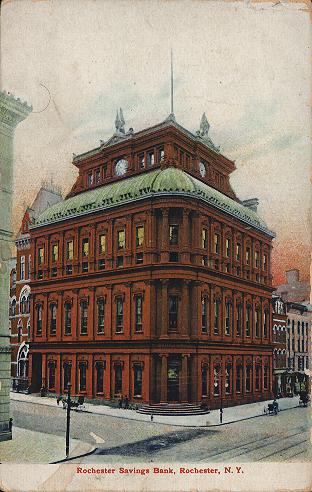
1831.
Rochester Savings Bank chartered. It is the first savings bank
west of Albany.
Started with $114 in deposits.
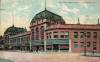
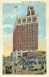
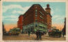
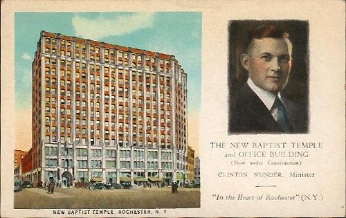
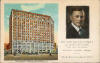 ◄1834.
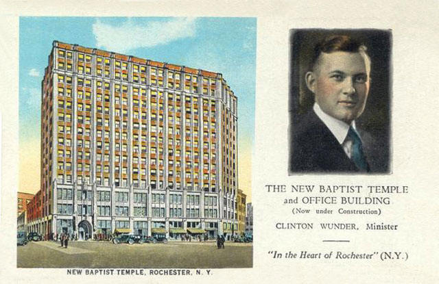
THE NEW BAPTIST TEMPLE
and OFFICE
BUILDING
(Now under
Construction)
Clinton
Wunder, Minister.
'In the Heart
of Rochester' (NY),
(Organized
1834).
The new
Temple, now being erected at North
and Franklin Streets,
inclusive of the site will be
valued at
$2,750,000. Fourteen stories high, it
will contain
an office building, retail stores, the
latest church
equipment for recreation, religious
education,
community service and worship. A
Hook and
Hastings organ, specially designed and
the largest
most complete church instrument
in this
section is now under construction. The
congregation
this year is giving $100,00 to
current
expenses, benevolences and the building fund.
The Temple is a church of, for
and by the
People who
"heard Jesus gladly.' 100,00 people
attended services last year.
When in Rochester, worship with
us. We meet in the
Lyceum Theatre until the greater
Temple
is completed. Temporary staff offices are
maintained at 66 North
Street.
Architects
for the new Temple,
Gordon &
Kaeber and
Carl R. Traver, Rochester, NY.
Contractors,
Thompson-Starret Company,
New York City
1834.
Postal rate 6 cents for 30 miles.
Rochester is incorporated as a city.
1838. First Rochester
murder
1846.
Liberty Pole erected on the hill at the triangular intersection of
East Avenue,
Main and Franklin Streets by the 'East Side
Boys'. Standing 118 feet tall with a 3 ft. diameter
brass ball on top,
it was a patriotic symbol. During national celebrations a 25 foot
banner was flown.
1846.
Josiah Bissell names East Avenue. He nails signs to trees
renaming old Main
Street
from the Liberty Pole to Pittsford. The name change becomes official
when Main Street is
extended from the Liberty Pole to
Goodman Street. He also made it the most
beautiful entry to the city by planting of a double row of horse
chestnut trees from his mansion to the Liberty Pole.
1852.
East Avenue Shade Tree Association plants elm trees on both sides of
the Avenue from the Liberty Pole to Culver's place to replace the
ailing horse chestnuts. The trees are fenced in, and hitching posts
provided at each house to prevent damage by horses. A man is hired
to care for the trees and to take action against anyone who allows
their cattle to run at large on the street.
1855.
Josiah Bissell nails signs to trees renaming old Main Street from the
Liberty Pole to Pittsford,
East Avenue. The name change becomes
official when Main Street is
extended from the Liberty Pole to
Goodman Street. In the late 1880's Main Street reaches Culver Road, and twenty five more years
pass before it is extended again to it's present end at Winton Road.
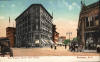
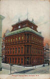 ◄1857.
Rochester Savings Bank opens on Main St. In 1877 the original two story
structure was enlarged by the addition of three more floors.
◄1857.
Rochester Savings Bank opens on Main St. In 1877 the original two story
structure was enlarged by the addition of three more floors.
1859.
Liberty Pole's foundation damaged in severe March gale, Authorities
cut down the 118 foot pole to prevent an accident.
Liberty Pole 101 ft. tall, 3-ft. diameter
top had brass ball and arrow
weather vane. It was located on the hill at Main & Franklin Streets.
1860.
Second Liberty Pole erected. 102 feet tall, it was topped by a large
wooden ball and a weather vane. During the Civil War a 30 x 17 1/2
foot American flag, and a 75 foot streamer were flown to show the
city's patriotic support.
 ◄1861.
First Liberty
Pole falls, second pole erected at same site. The first Liberty Pole erected in 1846, gave
way to this second pole, 1861-1889
◄1861.
First Liberty
Pole falls, second pole erected at same site. The first Liberty Pole erected in 1846, gave
way to this second pole, 1861-1889
1870.
Local farmers begin using the open area surrounding the Liberty Pole
as a market. This tradition continues for thirty years.
1877.
Run on the assets of Rochester Savings Bank stopped when they
display $1,000,000 in cash.
1880’s – The Liberty
Pole, Rochester, NY
1884.
Buffalo St.
has it's name changed to Main St.
1888.
Central Bank of Rochester
opens.
1889.
On December 26 the Liberty Pole
breaks and falls in a 72 MPH gale, on the day after Christmas. A
steel replacement is proposed, but is not built. A marker in the
pavement to note the site, disappears before the turn of the
century.
1897.
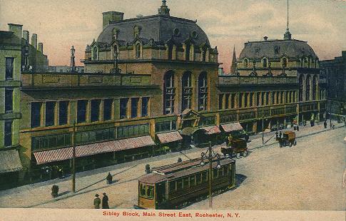
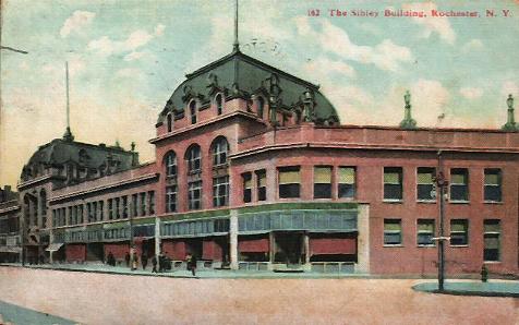
4.
The
Sibley
Triangle
Building,
(4)
20-26 East Avenue,
at the southeast corner of E. Main Street and
East Avenue, was designed by J. Foster Warner and built in
1897. Occupying a prominent site at the intersection of
East Avenue
and Main Street,
this triangular five-story
building was constructed by Hiram Sibley – realtor,
banker, philanthropist and heir to the fortune amassed by
his father, the builder of the Western Union Telegraph Company.
Its Neo-Classical and Romanesque design includes
large brick arches, a decorative cornice, and an arcade
of Roman-arched windows on the fifth floor.
 ◄Sibley
Block on Main Street
◄Sibley
Block on Main Street
 ◄Sibley
Building
◄Sibley
Building
1902.
Smallpox Epidemic kills 100. Dr. Goler is hero in fighting disease.
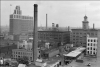
1904.
At 5 AM, Feb. 26 a fire starts in the Rochester Dry Goods Store on Main St., by noon
the entire block had been destroyed. Sibley's Department Store lost
$3,000,000 in buildings and inventory. Also lost was the company
safe containing the books showing the several hundred thousand
dollars owed the store. Within months voluntary payments were made,
estimated to be 90%
of what was owed. In just over a year a new, larger building was on
the site and open for business.
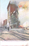 ◄1904.
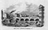
Scene during Great Fire of February 1904, Rochester, N.Y.
◄1904.
Scene during Great Fire of February 1904, Rochester, N.Y.
◄1904.
Sibley Fire, Rochester, N.Y.
February 26, 1904
1905.
2. Sibley Centre (2),
228 E. Main Street,
between N. Clinton Avenue and
Franklin Street,
was designed by J. Foster Warner and built in 1905 as a major
downtown department store. Construction of the present Sibley’s
started after a
disastrous fire destroyed the Sibley, Lindsay and Curr Company’s
former store. In
1911, the building was extended to Franklin Street; six
stories were added to this
addition in 1926 to create the Sibley
Tower
Building, the city’s
largest office building
at the time. The imposing, long-cherished landmark is a handsome
example of
the Chicago School
of architecture. Constructed of slender Roman-style bricks
with granite trim, the clarity and simplicity of its design was very
progressive for its
time. Only the landmark clock tower, with its copper dome, displays
ornamental
detail.
Sibley’s Place (2),
formerly Sibley’s Department Store, closed in 1989; in
1992, the Damon
City Center
opened here as the downtown campus on
Monroe
Community College. Today, in addition to the college, the building
houses offices,
and retail establishments.
1906.
Farmers Market at the Liberty Pole site is abolished.
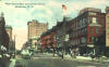
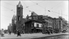
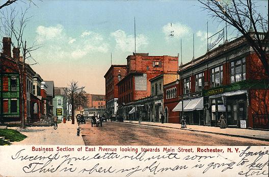
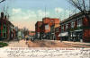 ◄1906.
Business Section of East Avenue looking towards Main Street,
Rochester, N. Y.
◄1906.
Business Section of East Avenue looking towards Main Street,
Rochester, N. Y.
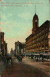
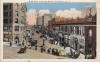
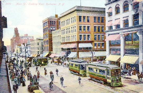
 ◄1908.
Main St.
Looking West, Rochester, N. Y.
◄1908.
Main St.
Looking West, Rochester, N. Y.
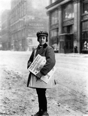
 ◄1910.
Newspaper Boy.
10-year-old
Marshall Knox delivers Saturday Evening Post newspapers on a snowy Main Street in Rochester, New York Photographed by
Lewis Wickes Hine on February 10, 1910.
◄1910.
Newspaper Boy.
10-year-old
Marshall Knox delivers Saturday Evening Post newspapers on a snowy Main Street in Rochester, New York Photographed by
Lewis Wickes Hine on February 10, 1910.
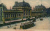
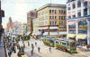
◄1910.
Main St. East showing Sibley, Lindsay & Curr Co., Department Store,
Rochester, N. Y.
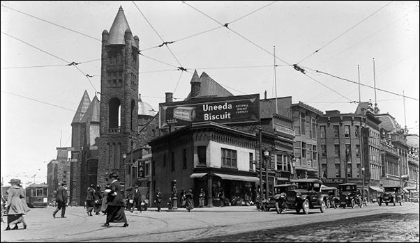
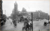 ◄1913.
In this 1913 photograph, the Second Baptist
Church steeple can be seen
behind the Triangle Block at Franklin, North and Achilles Streets.
The Church preceded the
Temple
Building at this downtown
location.
In the foreground, on
Main Street, a man stands above a horse
drawn wagon-based elevated platform to work on the overhead trolley
wires.
Photo: Copyright Albert R. Stone Negative Collection of the
Rochester
Museum and Science Center.
Printed in the Rochester
Herald November 23, 1913
1913.
Some merchants petition for trolley service, but there is opposition
because the narrow roadway. At the suggestion of the "East Avenue
Improvement Society" (Organized by James Cutler, who had recently
purchased and made available to developers four properties in the
area) the city suddenly began cutting down all the trees from Main
to Alexander. Before a protest could be organized by concerned
residents, the deed was done. The street was made wider and further
improvements promised.
 ◄1913.
Main St.
Illuminated, Rochester,
N. Y.
◄1913.
Main St.
Illuminated, Rochester,
N. Y.
1914.
Hiram W Sibley purchases Home of the Friendless at the NW corner of
Alexander and East for a business block opposite the Sibley Building
which he plans to build.
1914.
Earthquake frightens local citizens.
1918.
Influenza epidemic kills many.
1919.
Canal
closed in city. New route goes south of city through Genesee Valley Park.
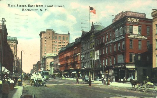
 ◄1919.
Main Street, East
from Front Street,
Rochester, NY
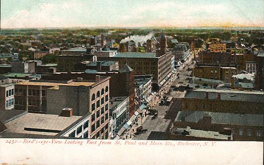
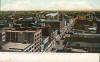 Birds-Eye View, Looking East from St. Paul
and Main Sts., Rochester, N. Y.
Birds-Eye View, Looking East from St. Paul
and Main Sts., Rochester, N. Y.
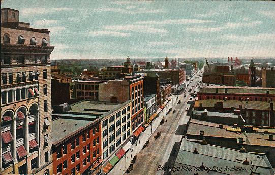
 Birds-Eye View, looking East, Rochester, N. Y
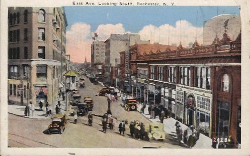
 East Ave.
Looking South, Rochester,
N. Y.
East Ave.
Looking South, Rochester,
N. Y.
East Avenue, Corner Main Street, Rochester,
NY
 ◄1920.
This
1920 photograph shows the "Triangle Block" at the junction of Main and North Streets. The Triangle Block was recommended
way back then, as a site for a memorial shaft, and indeed was later
used for the "Liberty Pole."
1920’s.
Noise and congestion of auto traffic destroy the genteel ambiance of
East Avenue. Wealthy residents leave for
quieter suburbs to the south and east.
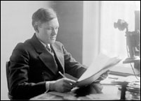
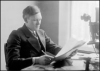 ◄1920’s.
Photo: "Reverand Clinton Wunder sitting at his desk." Copyright
Albert R. Stone Negative Collection of the
Rochester
Museum and Science Center.
Sometime in the early 1920's, Reverand Clinton Wunder, Pastor of the
Second Baptist Church,
convinced his congregation to build the Temple Building.
The parish had outgrown their existing Church. Rev. Wunder thought
that a nine story building would become an economic engine for the
Church's mission. Eventually the plans changed to a fourteen story
building. Many in the congregation thought that it was unwise to
build a fourteen story "Skyscraper Church."
◄1920’s.
Photo: "Reverand Clinton Wunder sitting at his desk." Copyright
Albert R. Stone Negative Collection of the
Rochester
Museum and Science Center.
Sometime in the early 1920's, Reverand Clinton Wunder, Pastor of the
Second Baptist Church,
convinced his congregation to build the Temple Building.
The parish had outgrown their existing Church. Rev. Wunder thought
that a nine story building would become an economic engine for the
Church's mission. Eventually the plans changed to a fourteen story
building. Many in the congregation thought that it was unwise to
build a fourteen story "Skyscraper Church."
1923.
One of the cities first overhead traffic lights is installed at the
corner of East and Main.
1924.
Bus service extended from Main Street down East Avenue to Alexander Street.
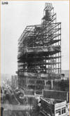
◄1924.
Photo: "The Temple
Building Skeleton."
Copyright Albert R. Stone Negative Collection of the
Rochester
Museum and Science Center.
Printed in the Rochester
Democrat and Chronicle March 1, 1925.
Rev. Wunder prevailed however, and a building committee, headed by
William Hartman was established. Originally the committee decided to
build a combined church and hotel. They changed direction though and
decided a combination church and office building would be better
suited for the needs of the church and also more profitable. Mr.
Hartman died suddenly in July 1923, but not before every penny of
the estimated $1,900,000.00 had been raised to build the Temple Building.
The existing church was quickly demolished and construction began
sometime in 1924. The congregation would temporarily worship in the
old Lyceum Theater. Arthur Castle, the chairman of the building
committee was determined to finish construction within one year, and
very nearly succeeded. Despite many trying circumstances, the new
Temple
Building was dedicated on
September 7th, 1925.
◄This
colorized architectural rendering of the future Temple Building
was produced by the local firm of Gordon & Kaelber. Along with Carl
R. Travers they designed the building. Tthe Thompson-Starett
Company, of New York City was the
Contractor.
During the early years of it's use, the splendid auditorium was
frequently filled to capacity, and it was not uncommon to turn folks
away. Rev. Wunder had strong oratorical skills and unusual
advertising and promotional abilities. Each year more than 100,000
people would walk through the
Temple
doors to attend worship services or an occasional debate. The Church
prospered and the Temple
Building
became one of Rochester's
landmark destinations.
 ◄Almost all of the early depictions of the
Temple
Building used for
promotion would show a trolly car or automobile in the image.
Reverand Wunder wanted the potential tenants, as well as their
customers, to know that the building was easily accessible by means
of modern transportation.
◄Almost all of the early depictions of the
Temple
Building used for
promotion would show a trolly car or automobile in the image.
Reverand Wunder wanted the potential tenants, as well as their
customers, to know that the building was easily accessible by means
of modern transportation.
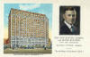
1925. The Temple
Building
(7)
was designed by Gordon & Kaelber and Carl R. Traver and built in
1925. Featuring pinnacles, pointed arches and decorative tracery, it is
Rochester’s only example of a 20th-century
Neo-Gothic skyscraper. The building is unusual in that it was
developed for both religious and office use. The
Second
Baptist Church,
founded in 1834, had a previous church on this site that no longer
accommodated its needs. They built a new 14-story structure that served both
religious and office functions and occupied it until
1965 when the Baptist congregation relocated to
Brighton.
1925.
Hiram
Sibley
Building
completed. The English Renaissance style building was a memorial to
the founder of Western Union.
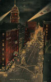
 ◄1925.
Remarkable Night Photo of Rochester,
New York: Photo shows what is
probably the most remarkable night view ever taken of any
city in the world. The picture is not alone remarkable for
the fact that it was taken at night but for the fact that
objects at a half mile distance were shown with astonishing
clearness. The photo was taken with the aid of 50 pounds of
flashlight powder, thought the heaviest charge of power ever
used to make a picture. The camera used was an ordinary new
camera such as is used for all news pictures day in and day
out. The flash that enabled the photo is to be made was
dropped from an airplane by the arm scientists who conducted
the first experiment of its kind in night aerial photography
ever attempted anywhere.
Photographed November 23, 1925.
◄1925.
Remarkable Night Photo of Rochester,
New York: Photo shows what is
probably the most remarkable night view ever taken of any
city in the world. The picture is not alone remarkable for
the fact that it was taken at night but for the fact that
objects at a half mile distance were shown with astonishing
clearness. The photo was taken with the aid of 50 pounds of
flashlight powder, thought the heaviest charge of power ever
used to make a picture. The camera used was an ordinary new
camera such as is used for all news pictures day in and day
out. The flash that enabled the photo is to be made was
dropped from an airplane by the arm scientists who conducted
the first experiment of its kind in night aerial photography
ever attempted anywhere.
Photographed November 23, 1925.
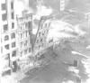
 ◄1925.
This 1925 aerial photograph shows the Temple
Building
to the north. Off to the right you can see the
Triangle
Building and Cutler Building
on East Avenue.
Besides the Sibley Buiding on
Main Street, they are the only Triangle
Block buildings still standing. The Temple Building was a marvelous and long lasting addition to
the Rochester
skyline.
Gordon and Koelber, original designers/builders of the Temple
Building were also credited with the building of the Eastman
Theater, the Columbus Building (known today as 50 Chestnut Plaza,)
The Sagamore Hotel (known today as 111 East Avenue,) the Rundel
Memorial Public Library and the Cutler Union at the Memorial Art
Gallery.
Photo: Copyright Albert R. Stone Negative Collection of the Rochester Museum
and Science Center
◄1925.
This 1925 aerial photograph shows the Temple
Building
to the north. Off to the right you can see the
Triangle
Building and Cutler Building
on East Avenue.
Besides the Sibley Buiding on
Main Street, they are the only Triangle
Block buildings still standing. The Temple Building was a marvelous and long lasting addition to
the Rochester
skyline.
Gordon and Koelber, original designers/builders of the Temple
Building were also credited with the building of the Eastman
Theater, the Columbus Building (known today as 50 Chestnut Plaza,)
The Sagamore Hotel (known today as 111 East Avenue,) the Rundel
Memorial Public Library and the Cutler Union at the Memorial Art
Gallery.
Photo: Copyright Albert R. Stone Negative Collection of the Rochester Museum
and Science Center
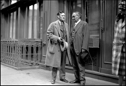
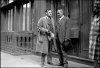 ◄1926.
Back in 1926, the Rev. Clinton Wunder and Clarence Darrow stand on a
sidewalk with their hats in their hands. Darrow had just arrived in
Rochester for a debate at the Temple
Building
with Rev. Wunder on the topic "Has Life A Purpose?" Darrow's
argument was based on his bold agnostic theories.
Photo: Copyright Albert R. Stone Negative Collection of the
Rochester
Museum and Science Center.
Printed in the Democrat and Chronicle October 30, 1926.
◄1926.
Back in 1926, the Rev. Clinton Wunder and Clarence Darrow stand on a
sidewalk with their hats in their hands. Darrow had just arrived in
Rochester for a debate at the Temple
Building
with Rev. Wunder on the topic "Has Life A Purpose?" Darrow's
argument was based on his bold agnostic theories.
Photo: Copyright Albert R. Stone Negative Collection of the
Rochester
Museum and Science Center.
Printed in the Democrat and Chronicle October 30, 1926.
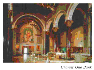
 1929.
Charter One Bank (8),
40 Franklin Street,
was designed by McKim, Mead and White of New York with J.
Foster Warner of Rochester and built in 1929. This outstanding
example of 20th-century Byzantine architecture exemplified the traditional banking house “temple of commerce”
theme. The restrained exterior belies the grandeur
of the interior glass wall mosaics, marble pavement mosaics,
decoratively painted wood-offered ceiling, and monumental Rouge
Antique marble columns. The painted
ceiling and the mosaics are the work of Ezra Winter, the American
muralist whose work also decorates the
Eastman Theatre interior.
1929.
Charter One Bank (8),
40 Franklin Street,
was designed by McKim, Mead and White of New York with J.
Foster Warner of Rochester and built in 1929. This outstanding
example of 20th-century Byzantine architecture exemplified the traditional banking house “temple of commerce”
theme. The restrained exterior belies the grandeur
of the interior glass wall mosaics, marble pavement mosaics,
decoratively painted wood-offered ceiling, and monumental Rouge
Antique marble columns. The painted
ceiling and the mosaics are the work of Ezra Winter, the American
muralist whose work also decorates the
Eastman Theatre interior.
◄1944.
Main and Clinton
Streets by Night, Rochester,
NY
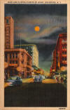
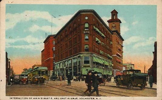
 ◄1951.
Intersection of Main Street E, and East Avenue, Rochester,
N. Y.
◄1951.
Intersection of Main Street E, and East Avenue, Rochester,
N. Y.
1962.
One East Avenu,
built in 1962, was originally constructed for the Security Trust
Company. It is now Fleet Bank. This striking example of 1960s architecture consists
of a two-story glass-enclosed public
banking facility, an adjoining 11-story tower, and an outdoor plaza.
The public banking facility is notable for its
imaginative roofline, glass walls, and Rochester artist John
Menihan’s 130-foot-long mural, a symbolic tribute
to the diversification of Monroe
County’s economy. The Tower building,
resting on stilts, is notable for its band
of quartz aggregate and gray-tinted glass.
1962.
Midtown Plaza,
designed by Victor Gruen Associates of Los Angeles, and built in
1962, was the nation’s first major urban shopping mall, and became a
much-publicized early example of downtown redevelopment.
Midtown comprises the interior of an entire city block and was
developed atop several levels of
underground public parking that connects existing buildings.
Directly opposite Midtown
Plaza on the north side of E. Main is
Sibley Centre, 228 E. Main Street, an
important early-20th-century retail building.
1964.
Controversial new Liberty Pole is erected. The 198 foot stainless
steel pole is supported by a network of steel wires forming a
triangle around it's base.

◄1965.
190 foot stainless steel Liberty Pole is built on the site of the
city's first pole. The official name of the triangular piece of land
where the pole is located is 'John
F. Kennedy Square' or 'Liberty Pole
Green'.
The
Liberty
Pole
was designed by Rochester architect James H. Johnson and built
in 1965. This modern steel sculpture is symbolic of earlier wooden liberty poles
that stood on the site between 1846 and
1889. This 20th-century work is expressive of a Colonial American
custom that originated in 1766, when the
first liberty pole in America was raised in
Manhattan
to celebrate
England’s repeal of the Stamp Act.
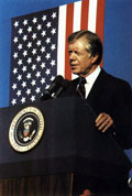
 ◄1980.
Jimmy Carter make Remarks at a Rally at
Liberty
Pole With Area Residents.
◄1980.
Jimmy Carter make Remarks at a Rally at
Liberty
Pole With Area Residents.
October 29th, 1980
Home |
Site History |
Liberty
Poles |
Live Web Cams
| Gallery |
Rochester Gifts |
Contact
Copyright © 2007-2012 TheLibertyPole.org. All Rights Reserved.

 The
area was
rich in plant life, first with ferns, mosses, and conifers, then
evolving to flowering plants, forest trees and palms.
Animal life
would include massive amphibians, and then the giant reptiles of the
land and air.
This region may have been home to early
horses, camels, rhinoceros and other animals that were driven off by
the advancing glaciers.
The
area was
rich in plant life, first with ferns, mosses, and conifers, then
evolving to flowering plants, forest trees and palms.
Animal life
would include massive amphibians, and then the giant reptiles of the
land and air.
This region may have been home to early
horses, camels, rhinoceros and other animals that were driven off by
the advancing glaciers.
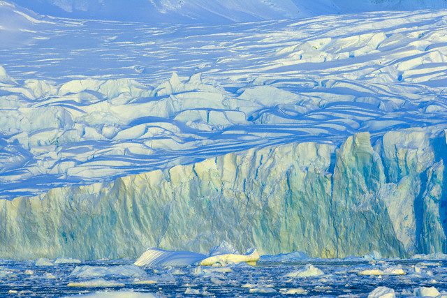 In the
last million years there have been four glacial ages that have
covered the area. Each age scraped and gouged, and sometimes buried
evidence of the previous glaciers. The earliest glacier to leave
evidence in the area arrived here 100,000 years ago. It was about
2,000 miles in diameter, and 1,000 to 10,000 feet high. This ice
would have put about a ton of pressure on each square inch of the
ground below. At the end of its 40,000 year stay it had compressed
the earth below by as much as 2,500 feet! Before the ice would
finally melt away, it would advance and recede across
In the
last million years there have been four glacial ages that have
covered the area. Each age scraped and gouged, and sometimes buried
evidence of the previous glaciers. The earliest glacier to leave
evidence in the area arrived here 100,000 years ago. It was about
2,000 miles in diameter, and 1,000 to 10,000 feet high. This ice
would have put about a ton of pressure on each square inch of the
ground below. At the end of its 40,000 year stay it had compressed
the earth below by as much as 2,500 feet! Before the ice would
finally melt away, it would advance and recede across